 |
225th Anniversary Commemoration
Legs 4, 5: Providence to CT BorderText and map markup by Ralph Nelson, Delaware Society SAR Photos by John W. Adams, Rhode Island Society SAR
|
Base maps are © 2005 DeLorme (www.delorme.com) Street Atlas USA
2006 May 27: Leg 4 of the RI Scout Hike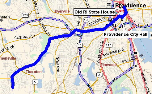
The group started at the Old State House in Providence and proceeded to the Market House at College Hill Bridge, west on Westminster, right on Dorrence past City Hall. Then left onto Washington St. and under I-95, turning left on Lafayette to Westminster, across the overpass and after 0.25 miles follow Nancy St about 1.5 miles to Neutaconkanut Hill Park. Continue 1.5 miles more (Nancy St becomes the Plainfield St.) and turn left on Stoney Acre Drive and stop at the back entrance to Boy Scout Camp Champlin. |
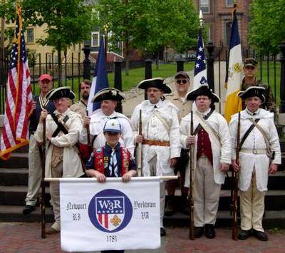
(L) Scouts, SAR members, and re-enactors of
the First Rhode Island Regiment at the old State House.
(R) The flag of France was flown to honor the French troops
who came to help the U.S. gain its independence in 1781.
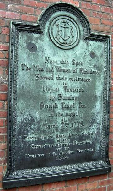
(L) The hikers paused to view a commemorative plaque
placed 112 years ago by the SAR and DAR.
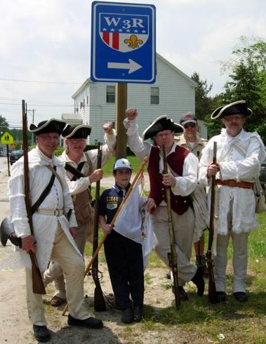
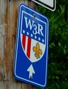
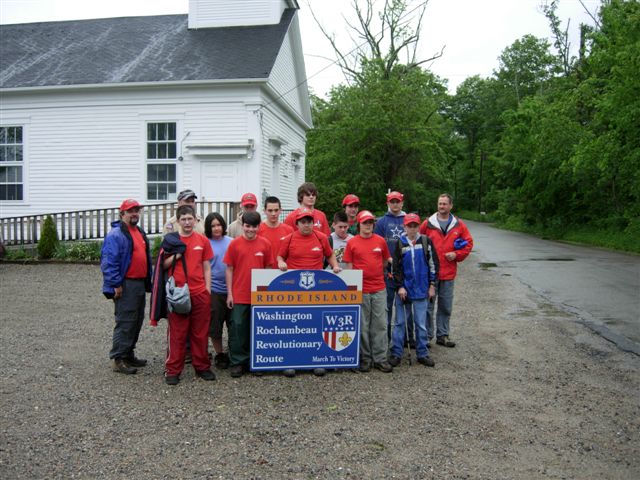
(R) W3R®-RI way-finding signs are being installed in Rhode Island.
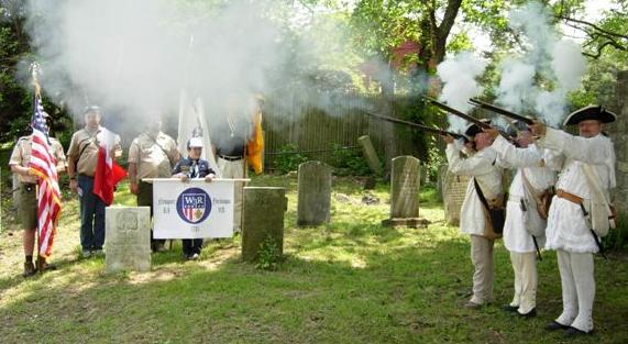
The First Rhode Island Regiment fired a musket salute to honor
the Revolutionary War patriots buried in the Cranston RI cemetery.
2006 June 04: Leg 5 of the RI Scout Hike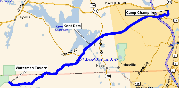
After a one-day delay due to heavy rains, the group started at Boy Scout Camp Champlin and went west on Rt 12 (Scituate Ave.), crossing Kent Dam. They continued straight on Burnt Hill Road, after 2.0 miles (at end) turned right (west) onto Hope Furnace Road, after 1.0 miles (at end) turned left (south-west) onto Matteson Road.
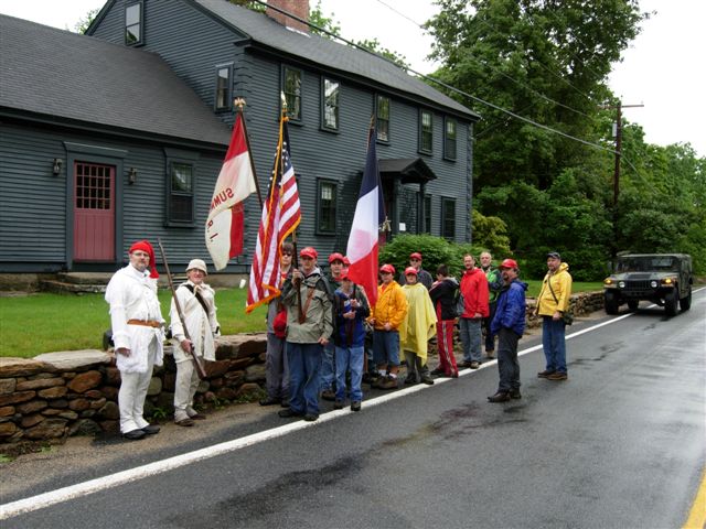
After 1.0 miles (at end) the turned right (west) on Maple Valley Road for 1.25 miles to the Rhode Island Historical marker at Waterman's Tavern. Nearby is the headstone and footstone of a grave reputed to be that of a French soldier who died during the Revolution. For many years local people placed an American flag on the grave. |
 The group passed many W3R®RI route-markers (wayfinding signs)
that have been placed along the trail from Newport to Providence
to where Rt 14A crosses into Connecticut.
The group passed many W3R®RI route-markers (wayfinding signs)
that have been placed along the trail from Newport to Providence
to where Rt 14A crosses into Connecticut.
 .
. 
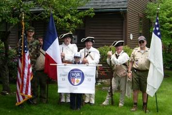
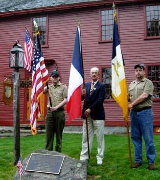
Left: US, French, and SAR flags at Waterman Tavern
Right: The grave of a French soldier buried near Waterman Tavern
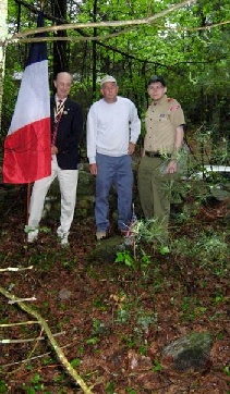
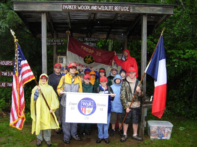
2006 June 10: Leg 6 of the RI Scout Hike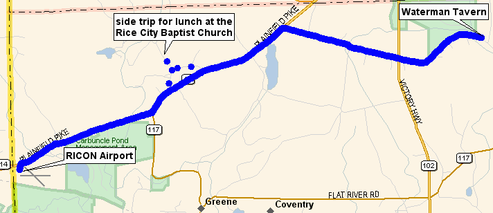
Twenty Scouts from Troop 39 spent a rainy ray hiking nearly to the Connecticut border, walking over some of the same dirt roads through the woods as four divisions of French troops, each 1,000 strong, did some 225 years ago -- young men not much older than the Scouts, but carrying eight-pound muskets and forty-pound packs containing all they would wear and own during the three years they were in the United States.
After lunch the group returned down Vaughn Hollow Road and right onto Lionel Pierson Road then right onto Rt 14 west, past Carbuncle Pond Management Area, ending at the RICON Airport. |
 Starting from the corner of Maple Valley Road and Biscuit Hill Road
(near Waterman's Tavern) the group followed the latter 1.75 miles,
crossing Rt 102, then turned left onto Rt 14 (Plainfield Pike).
They proceeded SW 2.25 miles, then took a side trip right onto
Lionel Pierson Road and then right onto Vaughn Hollow Road
to Rice City Baptist Church for lunch.
Starting from the corner of Maple Valley Road and Biscuit Hill Road
(near Waterman's Tavern) the group followed the latter 1.75 miles,
crossing Rt 102, then turned left onto Rt 14 (Plainfield Pike).
They proceeded SW 2.25 miles, then took a side trip right onto
Lionel Pierson Road and then right onto Vaughn Hollow Road
to Rice City Baptist Church for lunch.
Starting out in the rain
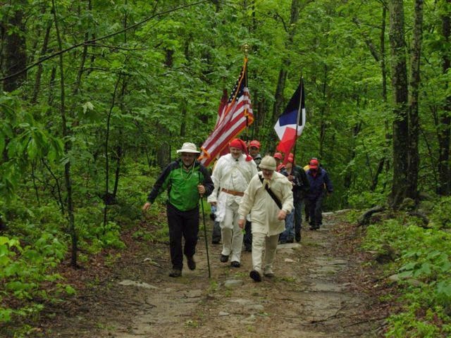
Hiking over the same rocks as greeted the French in 1781.
At the Mt. Vernon Tavern (built in 1761) the sun came out,
and the Second RI Regiment brought out its muskets.
The group posed with one of the "gateway" signs that will welcome
tourists on Rt 14 to the Rhode Island section of the trail.
| Go to Top of Page |