March and Ship Transport through Maryland
(and what is now the District of Columbia)
Latest changes:
2009-07-16 - split from page with VA /
NOTE: These W3R® campsite-and-trail maps were developed
during the 2000-2005 National Park Service study of significance,
feasibility, and environmental impact.
The orientation is tilted; north is about 45-degrees left of straight up.
==== MARYLAND ====
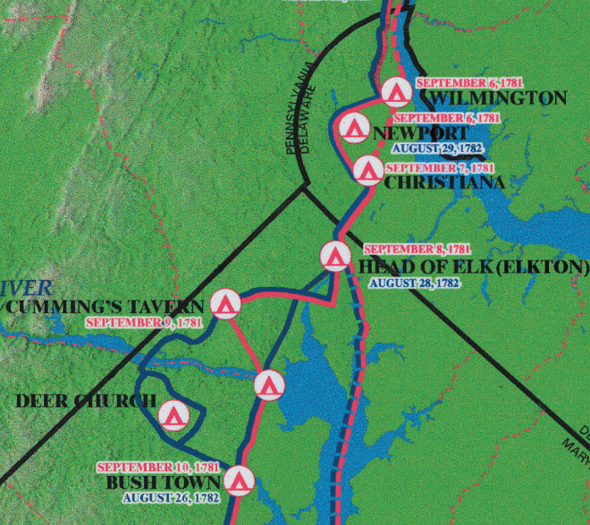
The northern MD portion of the W3R® campsite map
|
Sept 8 -- Head of Elk (now called Elkton) (18 miles from
Newport DE via Rt 4, Rt 7, Old Baltimore Pike, and MD Rt 281).
After Elkton (Head of Elk) the allied forces took several different routes,
as described in Marching to Victory, by Reyes and Fry.
Compare NPS maps below to Reyes and Fry's maps
Group A = On Sept 8th General Washington and his senior staff and guards rode to Baltimore (perhaps 45 miles via US Rt 7) Gen. Rochambeau and his senior staff and guards followed this route a day later, leaving Gen. Viomenil in command of the remaining French force travelling overland (Group C). On Sept 9 Washington continued to Mt. Vernon VA (45 miles on US Rt 1 and Rt 235 at Gum Hill). This was the first time in six years that Washington had seen his home. Rochambeau arrived there the next day. Group B = On Sept 8th about 1,000 American troops under General Lincoln and 1,000 French troops under the duc de Lauzun (but not his hussars) embarked from Plum Point (now Charlestown MD) on transports brought overland from Christiana DE or acquired locally. At Annapolis MD they were held up until Sept 12 by rough weather and waiting to hear about the outcome of the naval battle between Admirals Hood and de Grasse. They then continued by boat to Williamsburg VA. Group C was made up of C1 = 4,000 French infantry, C2 = 300 hussars from Lauzun's Legion (under Baron Ludwig von Closen and Cromot du Bourg), and C3 = the baggage train (220 wagons, 800 oxen, and 1,500 horses). On Sept 9 Group C passed through the Principio Iron Works (which had ceased operating about 1776) and camped at Lower Ferry (now Perryville) (14 miles via Rt 7). On Sept 10 Group C1 (the infantry) was ferried across the Susquehanna River
and went on to camp at Bush Town or Hartford (now Bush) (10 miles via Rt 7).
Meanwhile Groups C2 and C3 (the hussars and wagon train)
forded the Susquehanna River at Bald Friar Ford
(near the present Conowingo Dam, eight miles above Perryville)
and passed through Darlington, Indian Spring, and Churchville, rejoining
the infantry at Bush Town (on Rt 7 near Abington).
|
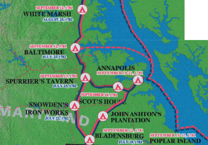
The middle MD portion of the W3R® campsite map.
On Sept 11 Group C travelled to White Marsh (10 miles via Rt 7),
then on Sept 12 travelled to Baltimore (12 miles via Rt 7).
They encamped at what later became the Camden Railroad Yards and is now
the Camden Yards Baseball Stadium. [The SAR placed a commemorative marker here.]
They remained here until Sept 15 before moving on to Annapolis to board
the French transport ships.
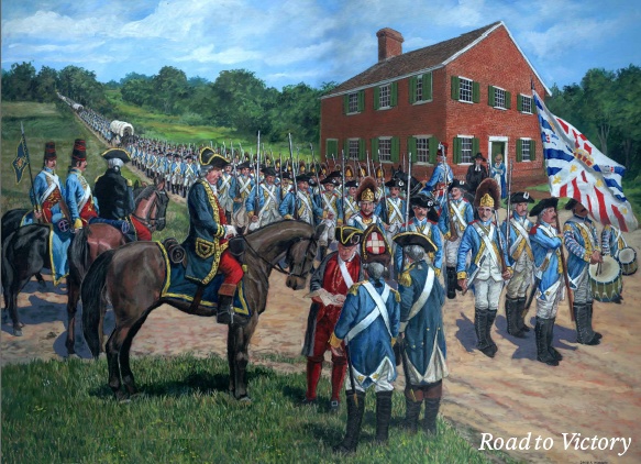
"Road to Victory" by  David R. Wagner David R. Wagner
(used with the artist's permission) On Sept 16 Group C travelled to Spurrier's Tavern (now Waterloo, 12 miles via Rt 1), and on Sept 17 they travelled to Scott's House (near Millersville, 11 miles via Rt 175). On Sept 18 they travelled to Annapolis (12 miles via Rt 178). Over the next three days 4,000 French infantry (Group C1) embarked on nine transports, escorted by a French ship-of-the-line, for a six-day trip to Jamestown VA. [The SAR participates in an annual ceremony at Annapolis to commemorate French aid during the Revolution.] The baggage train (Group C3) travelled south via Bowie, Bladensburg, Foggy Bottom [now in DC], and Georgetown [a part of Maryland at that time]. The auto route is eighteen miles via Rt 450 to Collington, then Rt 197 to Bowie, then ten miles via Rt 564 to Rt 450 to Bladensburg, then eight miles via Route 1 to Mt Vernon Square, then Rt 29 to Key Bridge. The hussars (Group C2) went from Annapolis to cross the Potomac River at Laidler's Ferry (Laidler's Lower Crossing) MD to Dalhgren VA. The auto route is 65 miles via Rt 50 and Rt 301 at Landover Hills. Group D = several Maryland Continental regiments (1,200 soldiers) under General Clinton. In Baltimore they joined the allied forces moving toward Yorktown. At Fells Point (in SE Baltimore) they boarded ships that had been assembled from the local area. |
| Top of Page |
