March through Pennsylvania 

Latest changes: 2009-07-16: split off DE /

NOTE: These W3R® campsite-and-trail maps were developed
during the 2000-2005 National Park Service study of significance,
feasibility, and environmental impact.
The orientation is tilted; north is about 45-degrees left of straight up.


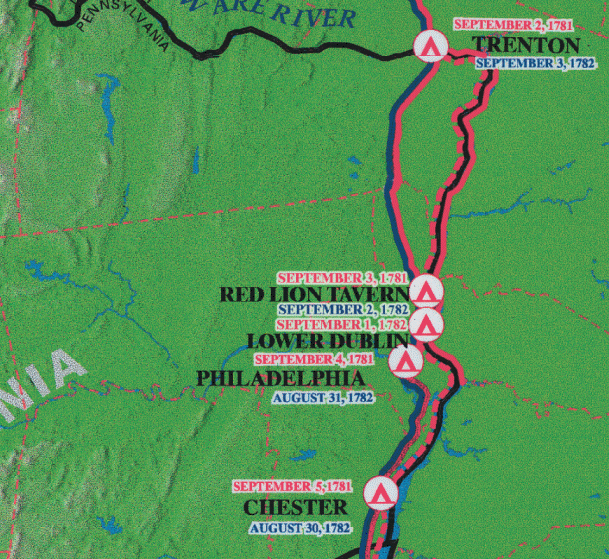
The Pennsylvania portion of the W3R® campsite map.

A Note about "Official" W3R® Routes

==== PENNSYLVANIA ====

Sept 2 -- Red Lion's Tavern (Bristol) (10 miles via Rt 13) 
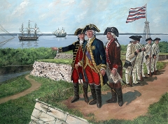
The American elements in the lead passed through Philadelphia on this day. They let their distress about lack of pay be known and demanded a month's pay before proceeding. American currency had collapsed, so Robert Morris (Superintendant of Finances for the Continental Congress) had to borrow $20,000 from Rochambeau in order to pay the American troops and continue the march.
==> Also on this day the French troops that had accompanied Admiral de Grasse's fleet began to disembark in Virginia to support Lafayette's American forces in keeping Cornwallis in Yorktown. In addition to the 1,800 men in de Grasse's ships' garrisons (to provide for their defense) there were 3,300 troops under the command of General (the marquis de) Saint-Simon:

  • Règiment d'Agenois, two battallions under Comte d'Autichamp
  • Règiment du Gâtinais under Marquis de Rostaing
  • Règiment de Touraine under Vicomte de Poudeux
  • Two companies of the Règiment d'artillerie de Metz
Saint-Simon placed himself under Lafayette's command until Rochambeau and Vioménil arrived [ref: Expèdition Particulièe (E.P.) Web site

Sept 3 -- Philadelphia (20 miles via Rt 13) The French troops, resplendent in their regimental uniforms and crisp style, paraded through town in two divisions on Sept 3 and 4.

Rosters for the French force at this time note 4,200 troops and non-commissioned officers, (an estimated 600 officers), 857 men in hospitals (including Boston and Newport), and 253 left behind on the road (messengers, guarding provisions). [Ref. Dr. Selig's report for Pennsylvania.]

Fort Mifflin is located on Mud Island, southeast of Philadelphia. It was originally built by the British to defend Philadelphia. At the start of the Revolution the Americans built Fort Mercer on the opposite bank of the Delaware River and added several lines of underwater obstructions to prevent the passage of large warships. Small warships, row-galleys, and fire ships provided mobile defense forces. In 1777 these held out for two months after Washington's defeat at Brandywine and had delayed supply ships from reaching the British troops in Philadelphia. This enabled Washington time to fortify Valley Forge so that he could survive the winter. Rochambeau took a side trip to visit this fort on his way to Chester PA.


"Rochambeau Visits Ft. Mifflin on His Way to Yorktown"
by David R. Wagner
(used with the artist's permission)

Sept 5 -- At Chester (10 miles via Rt 13) Washington received news of the British squadron continuing to New York without having engaged de Grasse's fleet, and he danced for joy.
==> Also on this day and unknown to Washington and Rochambeau, a naval battle was underway off the Chesapeake Capes between the fleets under de Grasse and Hood -- who had immediately returned from New York when he found that de Grasse had not gone there. The French inflicted serious damage on the British, who again sailed north to New York. Admiral de Barras' flotilla came from Newport by an easterly route farther out to sea and did not engage the British fleet. (See article: Battle off the Virginia Capes)